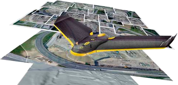
Surveys carried out with our own state of the art equipment such as
EBEE drones; dual frequency geodetic GPS, topo scanners and
TRIMBLE total stations.
High quality photogrammetry and geodetic survey services
precision.
Topographic studies for mines, roads, dams, transmission lines,
agriculture.
Urban and rural cadastre.
02
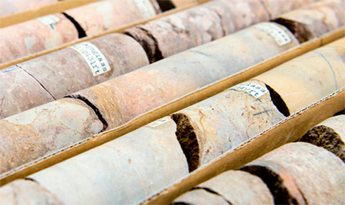
Hyperspectral scanning of drilling cores.
High resolution imaging and reflectance curves in all types of drilling samples.
Information processing and generation of high resolution true color images and false color hyperspectral mapping of mineral assemblages.
100% objective applications in lithological correlations, mapping and quantification of alteration assemblages, mineral paragenesis, mineralization vectors, definition of geo-metallurgical zones, determination of fracture frequency and filling, general condition of drilling cores, among others.